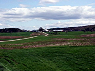
Enosburgh, Vermont, New England USA
About Enosburgh, Vermont
Franklin County
Chartered: May 15, 1780 (Vermont Charter)
Area: 30,926 Acres = 48.32 Square Miles [ Size Rank: 40* ]
Coordinates (Geographic Center): N 44° 54′ W 72°48′
Altitude: 422 feet ASL
Population (US Census, 2010): 2,781 [ Population Rank: 62* ]
Population Density (persons per square mile): 57.6 [ Density Rank: 75* ]
Full Census Info: Town County State
*Area, Population and Density rankings refer to Enosburgh’s relative position among Vermont’s 255 civic entities (9 cities, 242 towns, 4 gores and grants). Complete rankings are here.
One of the six towns (others being Berkshire, Richford, Montgomery, Wyllis (now Jay) and Westfield) granted in 1780 as a means of raising money to pay for Vermont’s participation in the Revolution. Many of the state’s founding fathers (Tom Chittenden, several Fays) were among the grantees; it is named for General Roger Enos, who had been commander of all Vermont forces; he was also Ira Allen’s father-in-law.
While a Connecticut resident, Enos had served with colonial troops, rising to rank of Colonel of the Second Connecticut Regiment. He commanded the rear guard under Benedict Arnold in the 1775 expedition to Quebec. Enos turned back with his troops, most of whom were ill, and was accused of cowardice and desertion, but eventually acquitted. Leaving Continental service, he moved to Vermont, where he came to be considered second to none in military matters, and gained the high esteem of the populace.
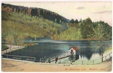
Activities & Points of Interest
Goings-on in and near Enosburgh
Calendar of Events provided by the Vermont Department of Tourism & Marketing.
Enosburgh Public Library
241 Main Street (behind the Town Clerk’s office). Books on tape, books on CD, a new video collection and some music CDs. Three public access computers with high speed connection. Adult book discussions (typically) monthly (call for schedule). Hours: Monday, 1-5, 7-8; Tuesday & Thursday, 10-4, Wednesday, 1-8; Friday, 10-8; Saturday, 10-12, 1-4. 802-933-2328.
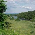
Misissquoi Valley Rail Trail
A 26-mile all-season recreation path which largely parallels Route 105 and the Missisquoi River between Richford and St. Albans. The packed gravel surface is suitable for walking or biking (wide tires are recommended) and XC skiing in winter. Closed to motorized vehicles except in winter. Easy access to refreshments at several points. As of the Fall of 2002, the trail is complete for its entire length, with the replacement of the collapsed segment of the former rail bridge at Sheldon Junction.
Vermont Dairy Festival
Three days of fun on the first eekend in June. How can you top the Cow-Pie Lottery?
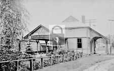
Covered Bridge (With Google Maps and satellite images):
Hopkins
Click Here for a map of all bridges in Franklin County.
Contact Info
Emergency Services (Statewide): 911
Hospital: Northwestern Medical Center (St. Albans) 802-524-5911
Town Clerk: Billie Jo Draper PO Box 465 Enosburg Falls, VT 05450
802-933-4421
M-F 8-4
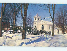
Churches, Ministries, Charitables
American Baptist : New Life Christian Church 802-933-2513
Episcopal : St. Matthew (Enosburg Falls) 802-933-6127
Roman Catholic : St. John the Baptist
United Methodist : Enosburg Falls UMC (Enosburg Falls) 802-933-4352
United Methodist : West Enosburg UMC (Enosburg Falls) 802-933-4352
Schools
Franklin Northeast Supervisory Union 802-848-7661
Cold Hollow Career Center 802-933-4003
Enosburg Falls Elementary School 802-933-2171
Enosburg Falls High School 802-933-7777
Enosburg Falls Middle School 802-933-7777
Neighboring Towns
This is a basic geographic reference, intended to show relative location of adjacent towns. Directional accuracy is limited to 16 compass points. There isn’t even the slightest suggestion that one can necessarily travel directly from one town to the next (as in “You can’t get there from here”).
Enosburgh
Businesses & Services
Rocheleau Appraisal
Fast Friendly Service for Northwestern Vermont
Utilities
Notes about utilities:
- One electric or phone company indicates that company serves the entire town. More than one of either indicates each serves different areas of town.
- A listed cable company MIGHT mean the entire town is covered, but not necessarily. More than one listed indicates each serves different areas of town.
- Unless your area is one served by Vermont’s only gas utility, your only option is bottled gas (any dealer).
Cable Comcast 800-266-2278
Electric Enosburg Electric Light Department 802-933-4443
Electric Vermont Electric Co-op 800-832-2667
Telephone Fairpoint 866-984-2001